
Pedalling nearly 4,500 km from Banff to the Mexican border isn’t your typical adventure and that's precisely why Jeff Bartlett decided to do it.
Billed as the longest off-pavement route in the world, Bartlett, a local Jasperite, and his friend Coburn Brown recently completed the Great Divide Mountain Bike Route, which crisscrosses the Continental Divide at least 32 times.
The 26-day trek took the duo through British Columbia and seven U.S. states before finally ending in Douglas, Ariz. at the Mexican border.
“We decided to do this together because he’s the only guy that I know that when you call him and say ‘do you want to bike to Mexico?’ he says yes,” said Bartlett with a chuckle.
The duo set off from Banff on July 27 and spent the first two days traversing the Canadian Rockies before crossing into Montana at the Roosville border crossing, about 70 kms south of Fernie, B.C.
“Day three and four was the only time during the whole trip that we had doubts about finishing,” said Bartlett.
“Both of us weren’t talking about it, but in our minds we were both battling with the idea that maybe our legs weren’t going to be up for it.”
Battling self-doubt, the pair woke up on day five refreshed and feeling up for the challenge.
“We felt way better than we had the day before and from then on it felt like we got stronger every day,” he said.
With 32 litres of equipment strapped to their Surly Krampus bikes—a cross between a regular mountain bike and a fat bike—the pair rode about 160 kms per day through the first three or four days, before slowly increasing their average distance to at least 200 kms a day.
Without a support crew, the pair regularly spent the night camping and cooking their own food on a gas stove. Occasionally they would stay in a hotel if they were near civilization.
“We stayed in four hotels along the way, but every other night we just camped. We never paid for camping, we just wild camped everywhere along the way.
“The worst campsite we camped at was underneath a bridge on a rainy night in a cow pasture,” said Bartlett. “That wasn’t terribly nice.”
To keep them on the track, they used a GPS tracking device and several maps, which showed them where the important amenities were along the route.
“Navigation certainly was the least of our concerns,” said Bartlett. “I think the more difficult part was using the maps and figuring out just how much food and water you needed between points.
“In Alberta, B.C. and Montana that was easy because there are rivers everywhere and you can just treat the water and drink, but as we got into Wyoming, Colorado and New Mexico there is no surface water.”
They ran out of water at least once in New Mexico, with 30 to 40 kms until their next pit stop and came dangerously close to running dry several other times.
“You basically stop drinking water and nurse it as much as possible,” he said, explaining they would stop in towns to get tap water or occasionally find a house with a well.
“Some of the smaller towns even have a community well that you can go and use.”
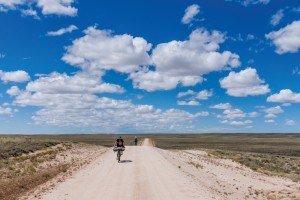
During one stretch in Wyoming, called the Great Divide Basin, there were no amenities for 250 kms, except for a reservoir that was located around the halfway point and about four kms off route.
In New Mexico there was another section that was 300 kms long with absolutely no water, except for a U.S. Forest Service workstation, which miraculously had a Coke machine and running water, said Bartlett.
To ensure they had enough water during the longer stretches, they used a six-litre dromedary bag.
“We always carried a litre and a half each when water was plentiful and then we’d use a six-litre bag as our emergency water.”
During the tour, the duo climbed nearly 50,000 metres in elevation and battled everything from thunderstorms to hail and extreme temperatures.
“We probably saw or rode through thunderstorms 20 of the 26 days,” said Bartlett.
“Our joke the whole trip was we didn’t need to have maps or the GPS because if we just biked towards the thunderstorms or the head winds we’d always be going in the right direction.”
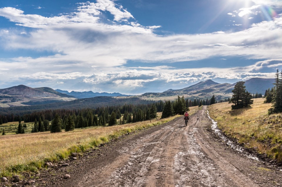
About 90 per cent of time, the pair followed gravel roads, which would occasionally turn into a single track or paved road.
“Pretty much the whole way was absolute massive climbs that would be 30 to 50 kms of climbing and then you’d get a 20 to 50 km downhill on the other side. You’d do one or two of those a day.
“New Mexico wasn’t the highest elevation, but they were the biggest climbs because you’d start down at a low elevation and have to climb six or seven thousand feet.”
Nearing the end of the tour in New Mexico, the heat began to catch up with Bartlett.
“On the third last day I was definitely getting to the sunstroke point where I was sitting in the shade and starting to talk nonsense and it was 50 kms in either direction to any sort of help.”
Despite his ailing body, the duo trekked on.
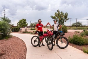
Traditionally the route ends at Antelope Wells, New Mexico, but because there are few amenities there, they decided to cut west at Lordsburg and bike 160 kms to Douglas, Ariz., another border crossing, with more amenities and services.
The pair finished the tour Aug. 21 and returned to Canada Aug. 24.
Asked what advice he would give others who might be considering the adventure, Bartlett said: “Just go and do it.”
Paul Clarke
[email protected]